Florida Memory is administered by the Florida Department of State, Division of Library and Information Services, Bureau of Archives and Records Management. The digitized records on Florida Memory come from the collections of the State Archives of Florida and the special collections of the State Library of Florida.

State Archives of Florida
- ArchivesFlorida.com
- State Archives Online Catalog
- ArchivesFlorida.com
- ArchivesFlorida.com
State Library of Florida
Related Sites
7 items found
| Identifier | Title | Type | Subject | Thumbnail | |
|---|---|---|---|---|---|
| fmc0231 | Map of America and the New World, 1819 | America--Maps. Pacific Ocean--Maps. | /FMP/maps/thumbnails/fmc0231.jpg | ||
| fmc0287 | Map of Great Britain's dominions in Europe, Africa, and America, 1759 | Great Britain--Colonies--18th Century--Maps--Early works to 1800. North Atlantic Region--Maps--Early works to 1800. | /FMP/maps/thumbnails/fmc0287.jpg | ||
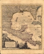
| fmc0295 | Map of Mexico, California, New Mexico, 1752 | Mexico--Maps--Early works to 1800. Central America--Maps--Early works to 1800. Southern States--Maps--Early works to 1800. Southwest, New--Maps--Early works to 1800. Slavery in art. | /FMP/maps/thumbnails/fmc0295.jpg | ||
| fmc0292a | Map of North America, 1687 | North America--Maps--Early works to 1800. | /FMP/maps/thumbnails/fmc0292a.jpg | ||
| fmc0269 | Map of North America, 1763 | North America--Maps--Early works to 1800. | /FMP/maps/thumbnails/fmc0269.jpg | ||
| fmc0252 | Map of the British Empire in America : with the French, Spanish and Hollandish settlements included, 1734 | North America--Maps--Early works to 1800. | /FMP/maps/thumbnails/fmc0252.jpg | ||
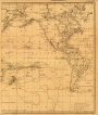
| fmc0296 | Voyages of Captain James Cook, 1768-1780 | Cook, James, 1728-1779--Journeys--Maps--Early works to 1800. Pacific Ocean--Discovery and exploration--Maps--Early works to 1800. North America--Maps--Early works to 1800. South America--Maps--Early works to 1800. | /FMP/maps/thumbnails/fmc0296.jpg |