Florida Memory is administered by the Florida Department of State, Division of Library and Information Services, Bureau of Archives and Records Management. The digitized records on Florida Memory come from the collections of the State Archives of Florida and the special collections of the State Library of Florida.

State Archives of Florida
- ArchivesFlorida.com
- State Archives Online Catalog
- ArchivesFlorida.com
- ArchivesFlorida.com
State Library of Florida
Related Sites
Maps
Discover hundreds of maps from the State Library and Archives of Florida dating from the 16th to the 20th century.
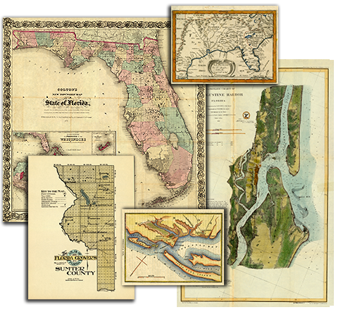
This collection consists of over 300 maps from the holdings of the State Library and Archives of Florida. The maps date from the 16th century to the 20th century, and include:
- Township maps, including maps showing the progress of the original government surveys.
- Highway and railroad maps.
- Maps showing the state's geological features.
- Nautical charts.
- Military maps.
- Maps of specific towns, counties, islands, harbors and bodies of water.
- Colonial era maps.
- Bird's-eye views of Florida cities and towns.
- Maps of the United States and the Western Hemisphere.
You can order high-resolution scans or prints by clicking the Order tab located below each map image.
Features
Territorial Legislative Council Records, 1822-1845
Documenting Florida's legislature prior to statehood
State and County Officer Directories, 1868-1969
Lists of Florida's state and county officials either elected or appointed between 1868 and 1969.

Guide to Military Records and the Wartime Experience
A guide to government records and manuscript collections relating to service members and the wartime experience.
Dust Tracks
21 tracks from Hurston's time documenting African American culture for the WPA in 1930s Florida.
History Day 2025
Resources for Florida History Day from the State Library and Archives of Florida.