Description of previous item
Description of next item
When Dade County Was On the Gulf Coast
Published March 3, 2015 by Florida Memory
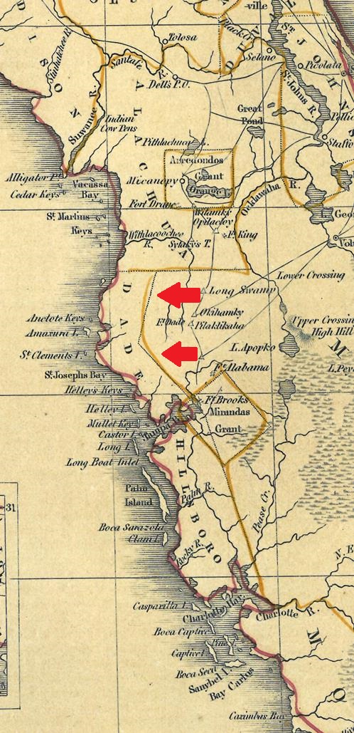
It doesn’t take a genius to realize map-making has come a long way since the early 19th century. Today’s Floridians would also likely agree that it shouldn’t take a genius to know where Miami-Dade County ought to be on a map of the Sunshine State. If that’s the case, then how in the world did THIS happen?

An 1838 map of Florida showing Dade County incorrectly on the Gulf Coast, just north of Tampa Bay (Florida Map Collection, State Library).
That’s right – in 1838, at least one mapmaker believed Dade County was supposed to be on Florida’s Gulf Coast north of Tampa Bay instead of down in South Florida on the Atlantic Coast where we would expect it to be. All jokes aside, the error in this case was probably only partly to do with the mapmaker’s wits and smarts. Some of the confusion likely resulted from the events leading up to Dade County’s establishment in 1836.
Prior to 1836, all of the land in what is now Miami-Dade County was part of Monroe County, which at that time contained everything south of an irregular line running from Charlotte Harbor on the Gulf coast, down to Lake Okeechobee (then called Lake Macaco) and down the course of the Hillsboro River to the Atlantic. When the territorial legislature met in January 1836, the representatives drew up a bill to create a new county using some of this expansive territory. Legislative records show that no representatives voted against the bill, not even Richard Fitzpatrick, Monroe County’s delegate.
The name didn’t provoke much debate either. Seven days before the legislative session convened, two companies of U.S. troops led by Major Francis Dade had fought one of the most violent battles of the Second Seminole War, in which Major Dade and a number of his men were killed. The legislators consequently agreed to name the new county “Dade” as a memorial to the fallen commander.

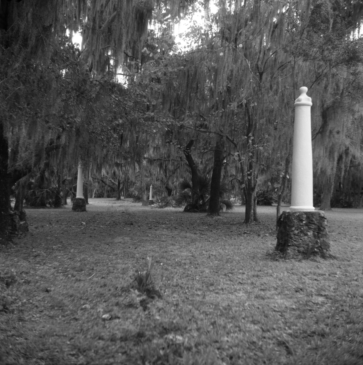
Historical markers at Dade Battlefield Historic State Park near Bushnell in Sumter County (circa 1950s).
Here’s where our mapmaker may have gotten into trouble. Since the new county was supposed to be a memorial to Major Dade, perhaps he thought it was supposed include the site of the late commander’s final battle. There was also a fort in the area that had just been renamed Fort Dade in the major’s memory – perhaps this was a contributing factor. It’s tough to say for sure. Even had this been the mapmaker’s thinking, Dade’s Battlefield is actually located more to the east in present-day Sumter County. More importantly, the act creating Dade County clearly situates it in the southeastern corner of the peninsula.
We may never know the full story behind Dade County’s short-lived Gulf coast career, but it’s one of those humorous little mistakes that help remind us that the historical actors we study were human beings. The history we learn from them wasn’t predetermined – it involved a multitude of individual decisions, actions, and even a few missteps.
This unusual map is one of over 1,700 individual items in the Florida Map Collection housed at the State Library in Tallahassee. Visit library.florida.gov to search the Library Catalog. If you want to limit your search to just maps, choose “Florida Map Collection” from the drop-down menu below the search box.
Cite This Article
Chicago Manual of Style
(17th Edition)Florida Memory. "When Dade County Was On the Gulf Coast." Floridiana, 2015. https://www.floridamemory.com/items/show/275768.
MLA
(9th Edition)Florida Memory. "When Dade County Was On the Gulf Coast." Floridiana, 2015, https://www.floridamemory.com/items/show/275768. Accessed January 23, 2026.
APA
(7th Edition)Florida Memory. (2015, March 3). When Dade County Was On the Gulf Coast. Floridiana. Retrieved from https://www.floridamemory.com/items/show/275768

 Listen: The Latin Program