Description of previous item
Description of next item
Florida's Own Prime Meridian
Published July 7, 2014 by Florida Memory
Every day, knowingly and more often unknowingly, we cross boundaries. We drive from one county into the next, we step across property lines, and we move in and out of the corporate limits of cities and towns. Visitors to Tallahassee’s recently renovated Cascades Park frequently cross a very important Florida boundary, now marked with an impressive new monument. It’s Florida’s own prime meridian, the initial point in the grid on which virtually all land surveying in the Sunshine State is based.
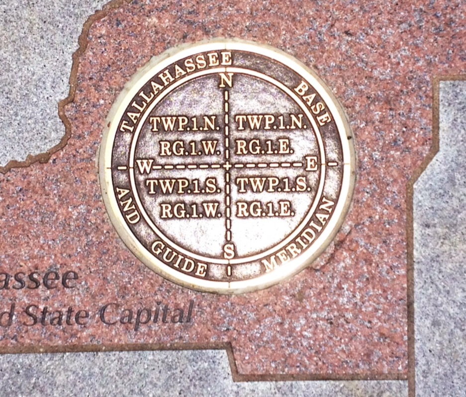
Brass plate marking the exact point at which Florida’s prime meridian crosses its base line. All of the six-mile square townships comprising the state’s land survey system are named in relation to this point. The point is located in Cascades Park, Tallahassee (photo 2014).
Initiating a system for identifying and selling land was a high priority for Florida’s earliest leaders. Settlers would be unlikely to take a chance establishing themselves in the new territory if there wasn’t a way to ensure the security of their title to the land they purchased. By the time Florida became a U.S. territory, the federal government already had a go-to method for measuring out new land. Called the Public Land Survey System, it called for the new territory to be divided into six-mile squares called townships, which were each further divided into 36 smaller one-mile squares called sections. Land grants for businesses, homesteaders, or government entities could then be sold off by the section or parts thereof.
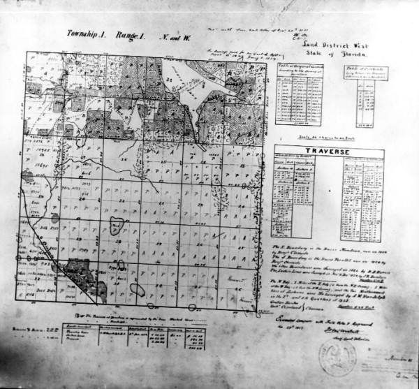
An early map of Township 1 North, Range 1 West, encompassing much of western Tallahassee. The map delineates the 36 one-mile square sections within the township, as well as numerous individual parcels of land that had already been purchased (1853).
The first step in laying out a township grid was to select a spot for it to start. When the order came down in 1824 for the surveying process to begin in Florida, the Surveyor General appointed for the territory, Robert Butler, had not yet arrived. Furthermore, territorial governor William Pope Duval was away from Tallahassee in conference with local Native Americans. Territorial Secretary George Walton, then, had the honor of selecting the location. How he made his selection is not precisely known, although some interesting stories have emerged over time. Probably the most popular version holds that while transporting a stone monument to the designated site it fell off its wagon about 200 yards short of its destination. Because of its immense weight, the legend explains, the stone was too heavy to put back onto the wagon, and consequently it was left where it fell and that became the point of beginning for Florida’s township grid. The story has a nice ring to it, but evidence suggests that the point was originally marked with a wooden stake, not a stone.
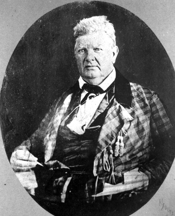
Robert Butler, Florida’s first Surveyor General. Butler had served as a military aide to General Andrew Jackson, and would establish one of the earliest plantations in the Tallahassee area on the southwest shore of Lake Jackson (photo circa 1860).
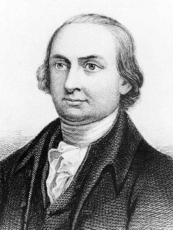
George Walton II, son of the George Walton who signed the Declaration of Independence. He served as Florida’s first Territorial Secretary (circa 1821).
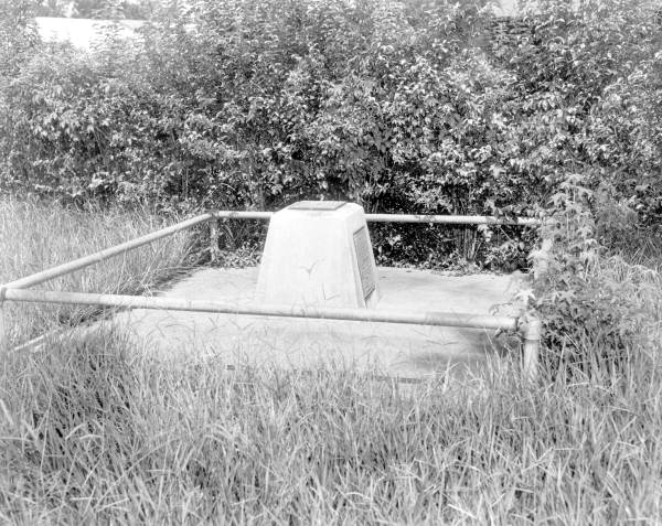
After the original point was established, surveyors began the lengthy process of establishing a north-south meridian and an east-west base line, dividing the territory into quadrants. The southeast quadrant contains the vast majority of Florida’s territory, as it includes the entire peninsula. As more townships were surveyed out in relation to these lines, the General Land Office began granting land to homesteaders and other buyers. The original point of beginning for the grid remained fairly obscure for the rest of the nineteenth century. In 1891, the City Commission of Tallahassee passed a resolution asking the General Land Office to establish a more elaborate monument marking the spot. The GLO gave orders for such a monument to be installed, and a local surveyor named John Cook identified a point on which to set it. This monument, however, for some reason appears never to have been placed. The one that existed before the Cascades Park renovation was erected by the Florida Legislature in 1925.
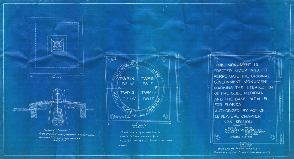
Blueprints for new monument to mark the original point of beginning for Florida’s township grid – the meeting place of the original prime meridian and base line (1925). Located in Box 1, folder 1 of Series 1152 (Subject Files of the Secretary of the Florida Senate), State Archives of Florida.
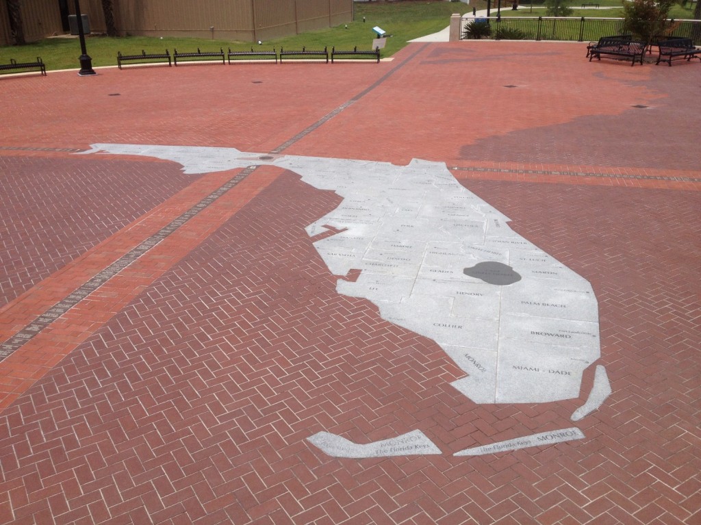
Today, Florida’s prime meridian is proudly displayed as a valuable historic site. Cascades Park was listed on the National Register of Historic Places in 1971, in part due to the presence of the prime meridian marker. When Cascades Park was renovated, the old 1925 concrete monument was removed and taken to the headquarters of the Florida Surveyors and Mappers Society in Tallahassee. The new monument, installed flush with the surrounding walking space, has been incorporated into an elaborate plaza that emphasizes the importance of the point for all of Florida.
Cite This Article
Chicago Manual of Style
(17th Edition)Florida Memory. "Florida's Own Prime Meridian." Floridiana, 2014. https://www.floridamemory.com/items/show/295193.
MLA
(9th Edition)Florida Memory. "Florida's Own Prime Meridian." Floridiana, 2014, https://www.floridamemory.com/items/show/295193. Accessed February 13, 2026.
APA
(7th Edition)Florida Memory. (2014, July 7). Florida's Own Prime Meridian. Floridiana. Retrieved from https://www.floridamemory.com/items/show/295193

 Listen: The Folk Program