Florida Memory is administered by the Florida Department of State, Division of Library and Information Services, Bureau of Archives and Records Management. The digitized records on Florida Memory come from the collections of the State Archives of Florida and the special collections of the State Library of Florida.

State Archives of Florida
- ArchivesFlorida.com
- State Archives Online Catalog
- ArchivesFlorida.com
- ArchivesFlorida.com
State Library of Florida
Related Sites
Description of previous item
Description of next item
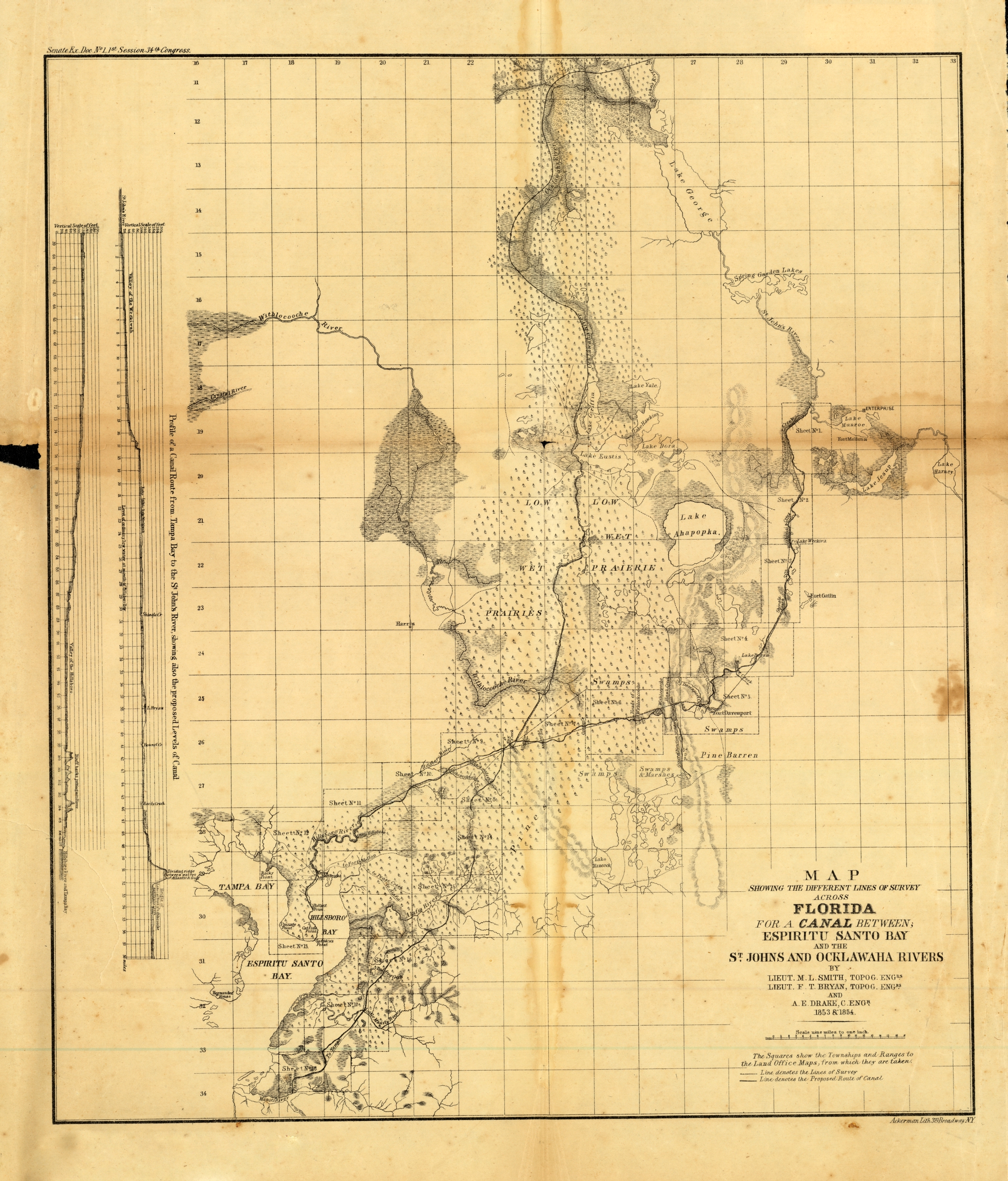
Canal Survey Map of St.Johns and Ocklawaha Rivers, 1854
Map showing the different lines of survey for a canal between Espiritu Santo Bay and the St. Johns and Ocklawaha Rivers
Canal Survey Map of St.Johns and Ocklawaha Rivers, 1854
Order Prints
Please select the size and options
Order Scan
High Resolution Scan - $20.00