Florida Memory is administered by the Florida Department of State, Division of Library and Information Services, Bureau of Archives and Records Management. The digitized records on Florida Memory come from the collections of the State Archives of Florida and the special collections of the State Library of Florida.

State Archives of Florida
- ArchivesFlorida.com
- State Archives Online Catalog
- ArchivesFlorida.com
- ArchivesFlorida.com
State Library of Florida
Related Sites
Description of previous item
Description of next item
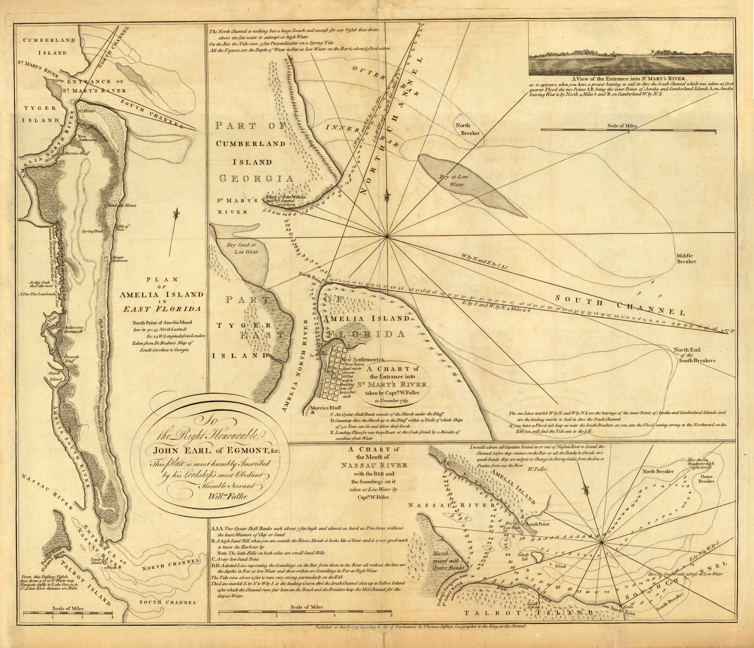
Amelia Island Plan and Natutical Charts, 1770
Plan of Amelia Island in East Florida ; a chart of the entrance into St. Marys River taken by Captn. W. Fuller in November, 1769 ; A chart of the mouth of Nassau River with the bar and the soundings on it taken at low water by Captn. W. Fuller.

Amelia Island Plan and Natutical Charts, 1770
Order Prints
Please select the size and options
Order Scan
High Resolution Scan - $20.00