Florida Memory is administered by the Florida Department of State, Division of Library and Information Services, Bureau of Archives and Records Management. The digitized records on Florida Memory come from the collections of the State Archives of Florida and the special collections of the State Library of Florida.

State Archives of Florida
- ArchivesFlorida.com
- State Archives Online Catalog
- ArchivesFlorida.com
State Library of Florida
Related Sites
Description of previous item
Description of next item
Title
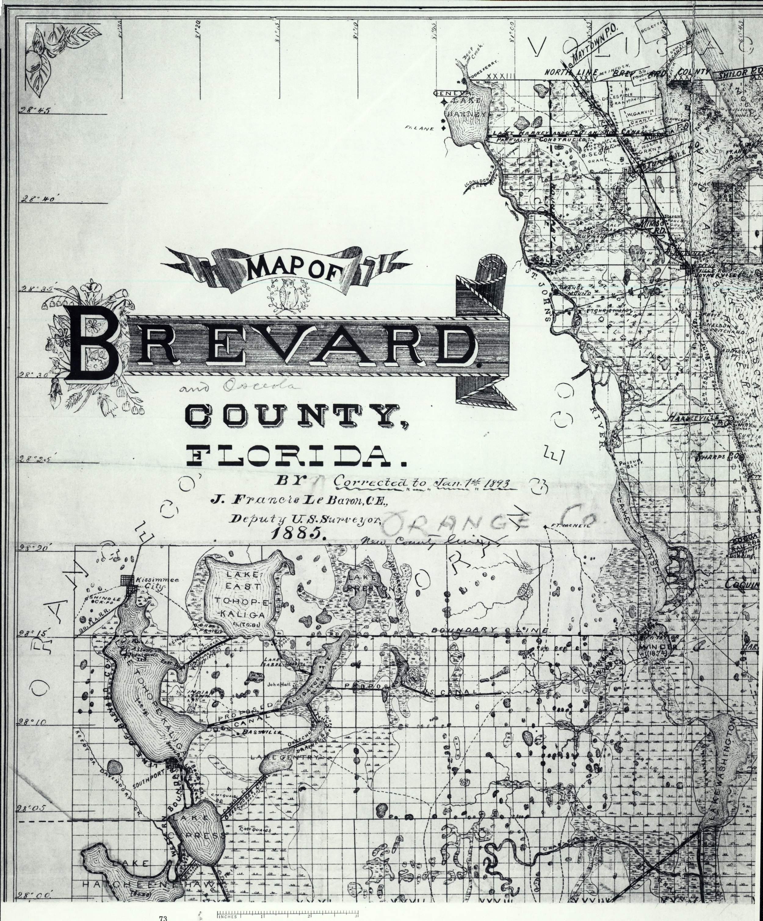
Map of Brevard County, 1893
Map Number
fmc0151a
Source
State Library of Florida, Florida Map Collection, GEOGRAPHIC AREA BREVARD COUNTY 0002
Date
1893
Creator
Additional Creator
Publisher
[United States : 20th century]
Physical Description
1 map on 4 sheets : photocopy ; 98 x 74 cm., on sheets 69 x 46 cm.
Scale
Scale [ca. 1:190,080] (W 81°35'--W 80°10'/N 28°45'--N 27°15')
General Notes
J. Francis Le Baron, C.E., Deputy U.S. Surveyor, 1885.
Corrected to Jan. 1st 1893.
Originally published: Jacksonville, Fla. : Published and for sale by J.F. Le Baron ..., [1893] (Boston : Photo-litho Forbes Co.)
Elevations given as spot heights. Depths given as soundings.
Adopted as the official map by the Board of County Commissioners, February, 1885.
Shows ranges, townships and sections.
Photostatic copy.
Includes state location map and section grid.
Map also includes land owned by John Hall, C. McQuaig's, Joel Tyson, Robt. Savage, Addison, Jones, C. Nelson, Prichard,
Fiume Boye, Hays, Fouchard, Rosette, Gomez, Crayon, Farrbanks, Watt, A. Jackson, Campbell, Futch, Stevens, Roberts, Harrison, Wilson, Fisher, Morrow, Blacks, Cooks Ferry, McIntosh, S.G. Gleason, Landing, Curtis Hotel, Evarettz.
Geographic Scope
Format
Subjects
Counties (1)
Land Grants (4)
B. Segui Grant
C. Costa Grant
Delespine Grant
West Garvin Grant
C. Costa Grant
Delespine Grant
West Garvin Grant

Map of Brevard County, 1893
Order Prints
Please select the size and options
Success: You have added Printed Map to your shopping cart!
How Will it Look?
Title
Map of Brevard County, 1893
Subject
Brevard County (Fla.)--Maps.
Creator
Le Baron, J. Francis.
Source
State Library of Florida, Florida Map Collection, GEOGRAPHIC AREA BREVARD COUNTY 0002
Publisher
[United States : 20th century]
Date
1893
Contributor
Forbes Co.
Format
maps
Language
eng-US
Identifier
fmc0151a
Coverage
Florida Boom and Progressive Era (1900-1926)
ImageID
fmc0151a
Physical Description
1 map on 4 sheets : photocopy ; 98 x 74 cm., on sheets 69 x 46 cm.
General Note
J. Francis Le Baron, C.E., Deputy U.S. Surveyor, 1885.
Corrected to Jan. 1st 1893.
Originally published: Jacksonville, Fla. : Published and for sale by J.F. Le Baron ..., [1893] (Boston : Photo-litho Forbes Co.)
Elevations given as spot heights. Depths given as soundings.
Adopted as the official map by the Board of County Commissioners, February, 1885.
Shows ranges, townships and sections.
Photostatic copy.
Includes state location map and section grid.
Map also includes land owned by John Hall, C. McQuaig's, Joel Tyson, Robt. Savage, Addison, Jones, C. Nelson, Prichard,
Fiume Boye, Hays, Fouchard, Rosette, Gomez, Crayon, Farrbanks, Watt, A. Jackson, Campbell, Futch, Stevens, Roberts, Harrison, Wilson, Fisher, Morrow, Blacks, Cooks Ferry, McIntosh, S.G. Gleason, Landing, Curtis Hotel, Evarettz.
Scope
County
County
Brevard County (Fla.)
Land Grant
B. Segui Grant
Delespine Grant
West Garvin Grant
C. Costa Grant
Scale
Scale [ca. 1:190,080] (W 81°35'--W 80°10'/N 28°45'--N 27°15')
Chicago Manual of Style
Le Baron, J. Francis. Map of Brevard County, 1893. 1893. State Archives of Florida, Florida Memory. <https://www.floridamemory.com/items/show/323132>, accessed 14 May 2025.
MLA
Le Baron, J. Francis. Map of Brevard County, 1893. 1893. State Archives of Florida, Florida Memory. Accessed 14 May. 2025.<https://www.floridamemory.com/items/show/323132>
AP Style Photo Citation
(State Archives of Florida/Le Baron)