Florida Memory is administered by the Florida Department of State, Division of Library and Information Services, Bureau of Archives and Records Management. The digitized records on Florida Memory come from the collections of the State Archives of Florida and the special collections of the State Library of Florida.

State Archives of Florida
- ArchivesFlorida.com
- State Archives Online Catalog
- ArchivesFlorida.com
- ArchivesFlorida.com
State Library of Florida
Related Sites
Description of previous item
Description of next item
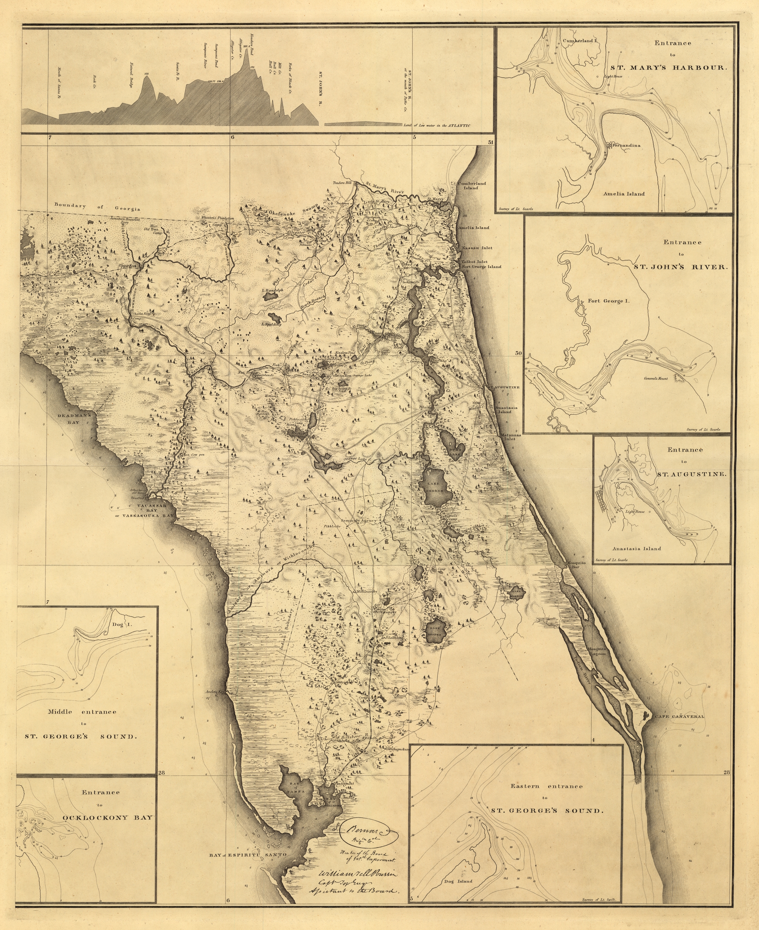
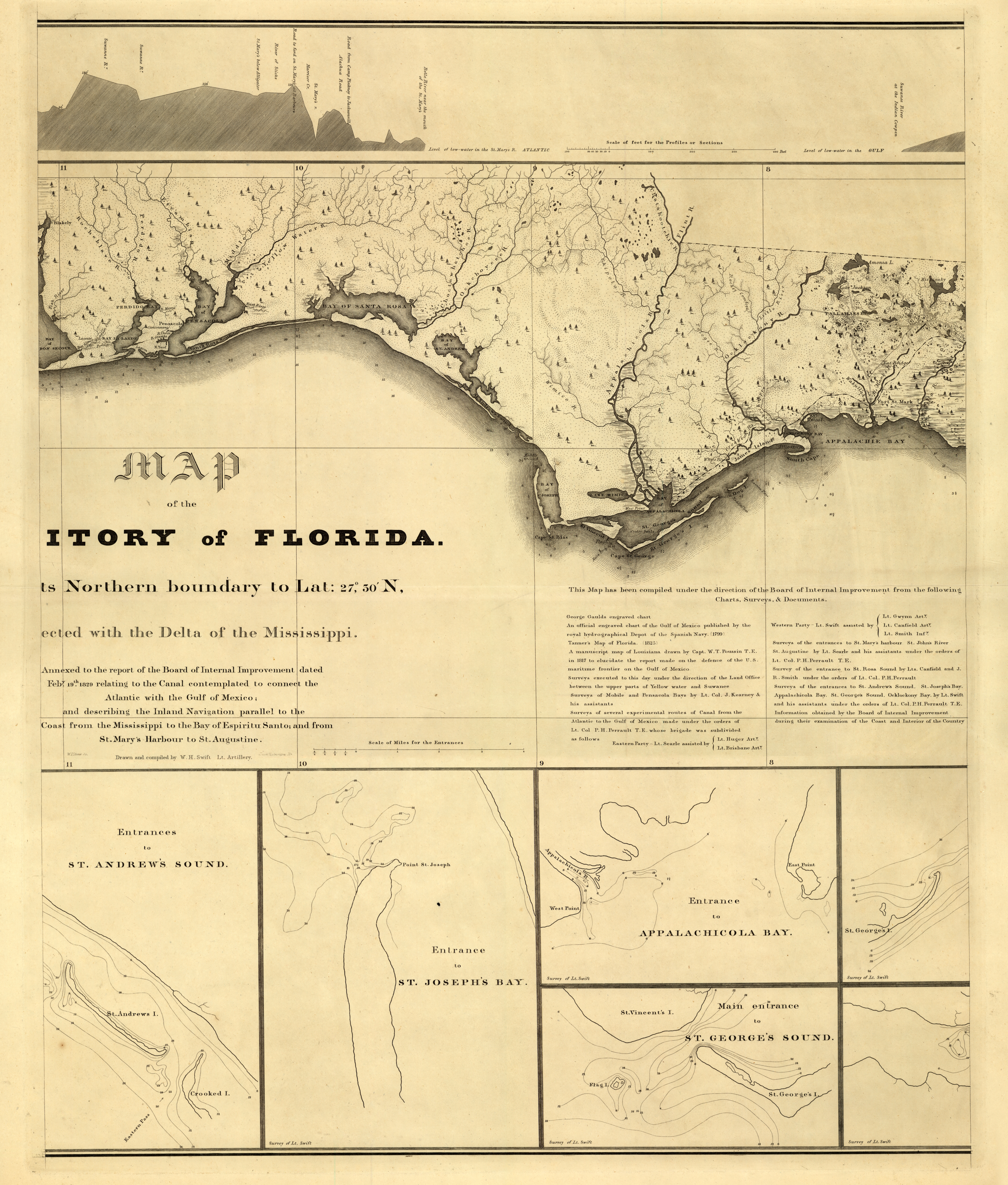
Map of Northern Boundaries of Territorial Florida, 1829
Map of the territory of Florida from its northern boundary to lat. 27°30ʹ N, connected with the delta of the Mississipi : annexed to the report of the Board of Internal Improvement dated Febry. 19th 1829 relating to the canal contemplated to connect the Atlantic with the Gulf of Mexico, and describing the inland navigation parallel to the coast from the Mississippi to the Bay of Espiritu Santo, and from St. Mary's Harbour to St. Augustine
Order Prints
Please select the size and options
Order Scan
High Resolution Scan - $20.00