Florida Memory is administered by the Florida Department of State, Division of Library and Information Services, Bureau of Archives and Records Management. The digitized records on Florida Memory come from the collections of the State Archives of Florida and the special collections of the State Library of Florida.

State Archives of Florida
- ArchivesFlorida.com
- State Archives Online Catalog
- ArchivesFlorida.com
- ArchivesFlorida.com
State Library of Florida
Related Sites
Voter Registration Rolls, 1867-68
Browse by County
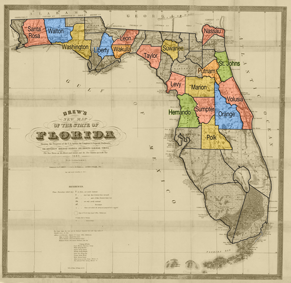
The highlighted sections of this map indicate counties for which voter registration rolls are available for 1867-68. To view the registration records from any of these counties, click on the county or choose it from the accompanying list.
Related Resources

Features
Territorial Legislative Council Records, 1822-1845
Documenting Florida's legislature prior to statehood
State and County Officer Directories, 1868-1969
Lists of Florida's state and county officials either elected or appointed between 1868 and 1969.

Guide to Military Records and the Wartime Experience
A guide to government records and manuscript collections relating to service members and the wartime experience.
Dust Tracks
21 tracks from Hurston's time documenting African American culture for the WPA in 1930s Florida.
History Day 2025
Resources for Florida History Day from the State Library and Archives of Florida.